
Ifield Parish Map
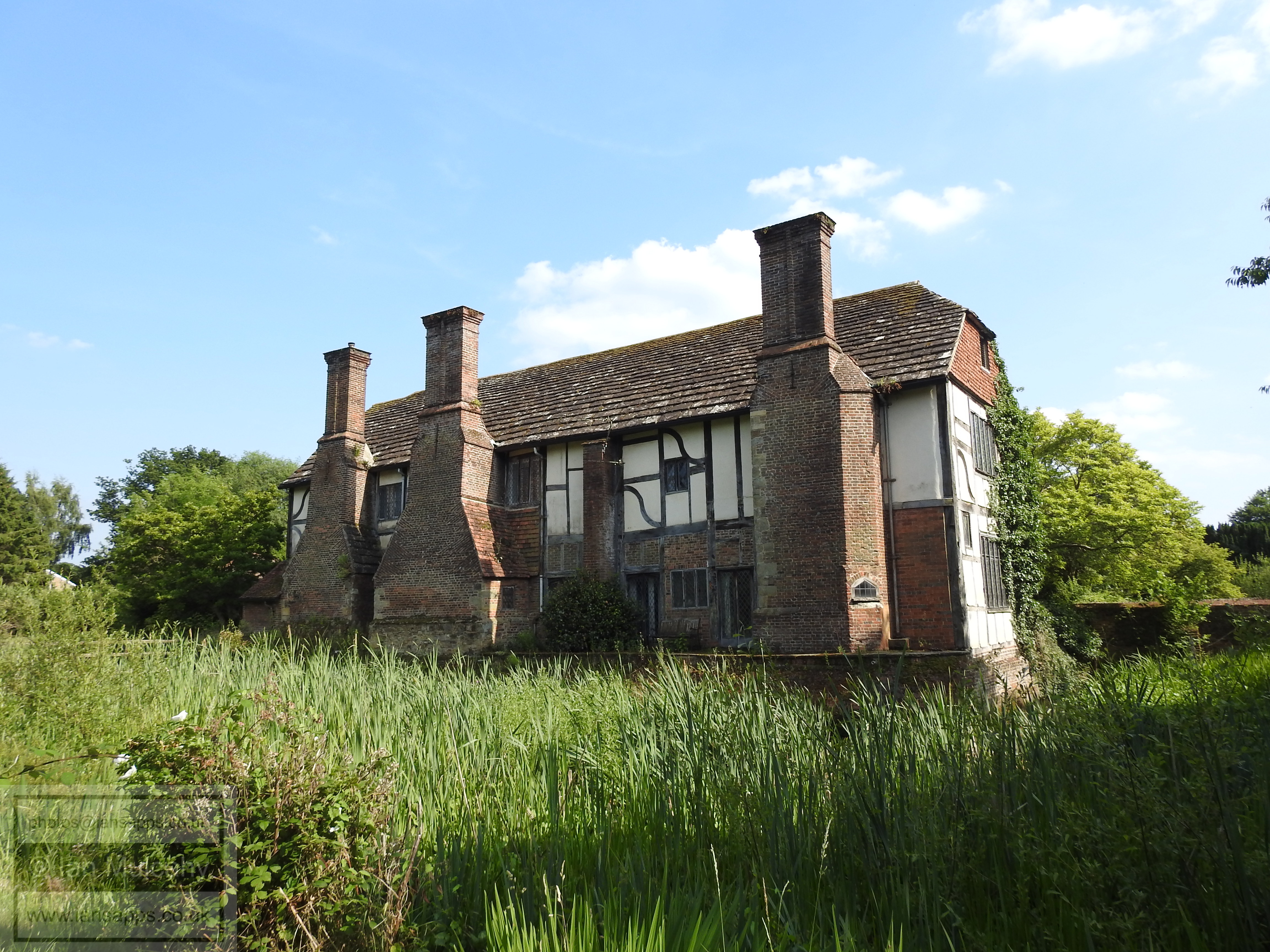
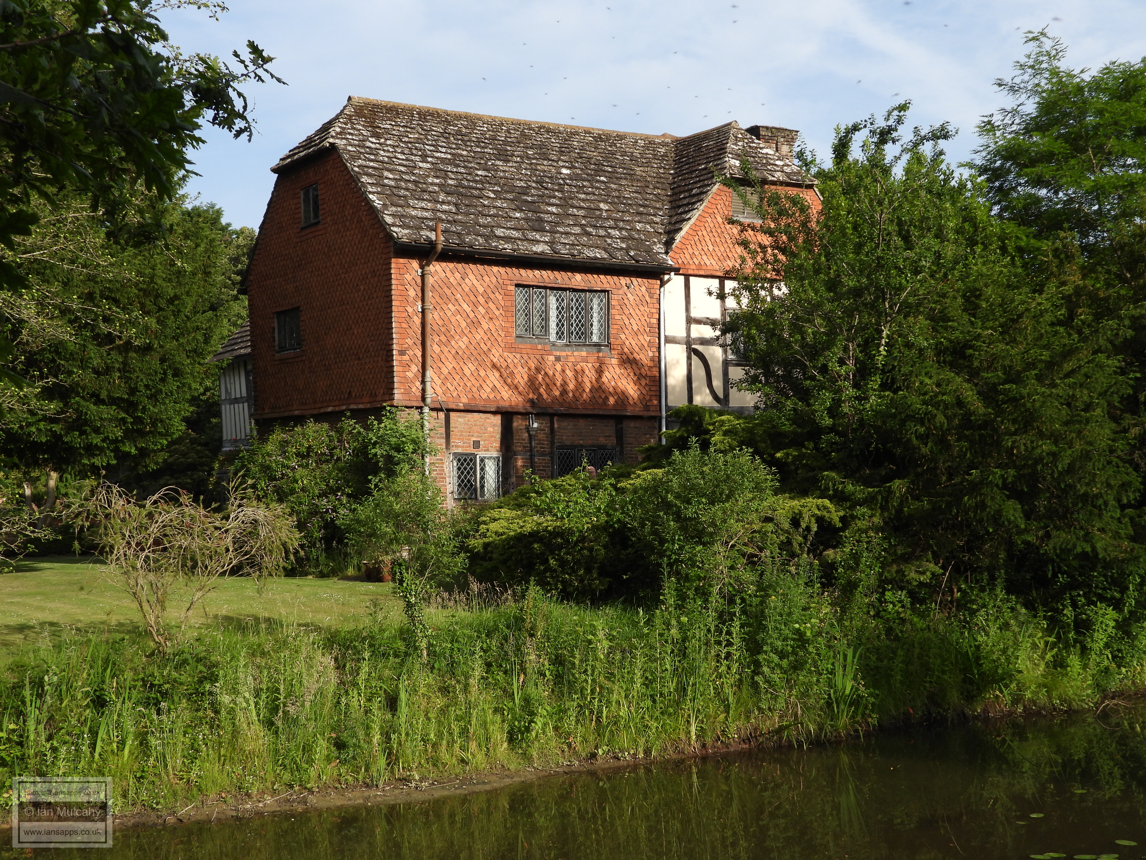
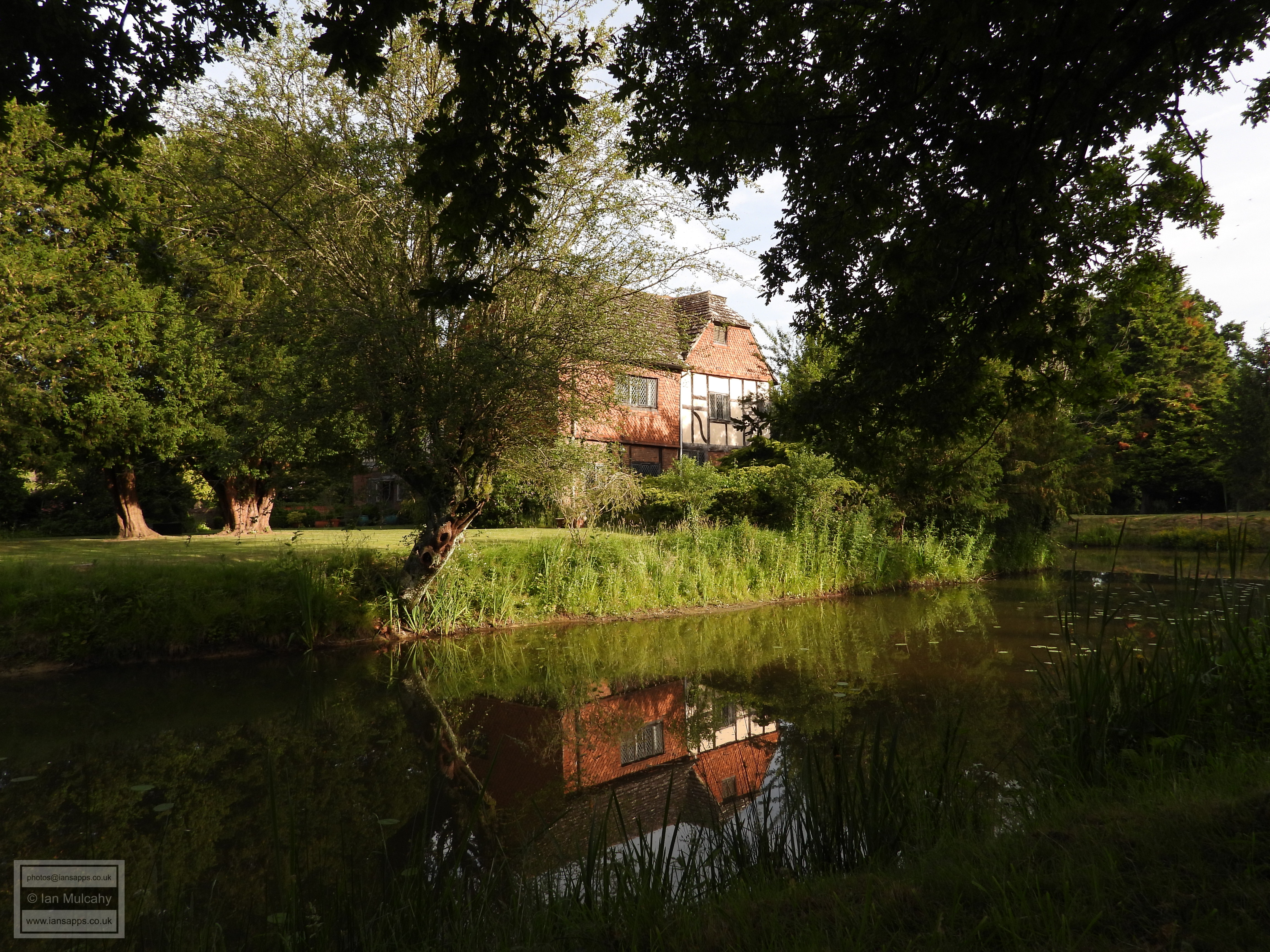
Ewhurst Place
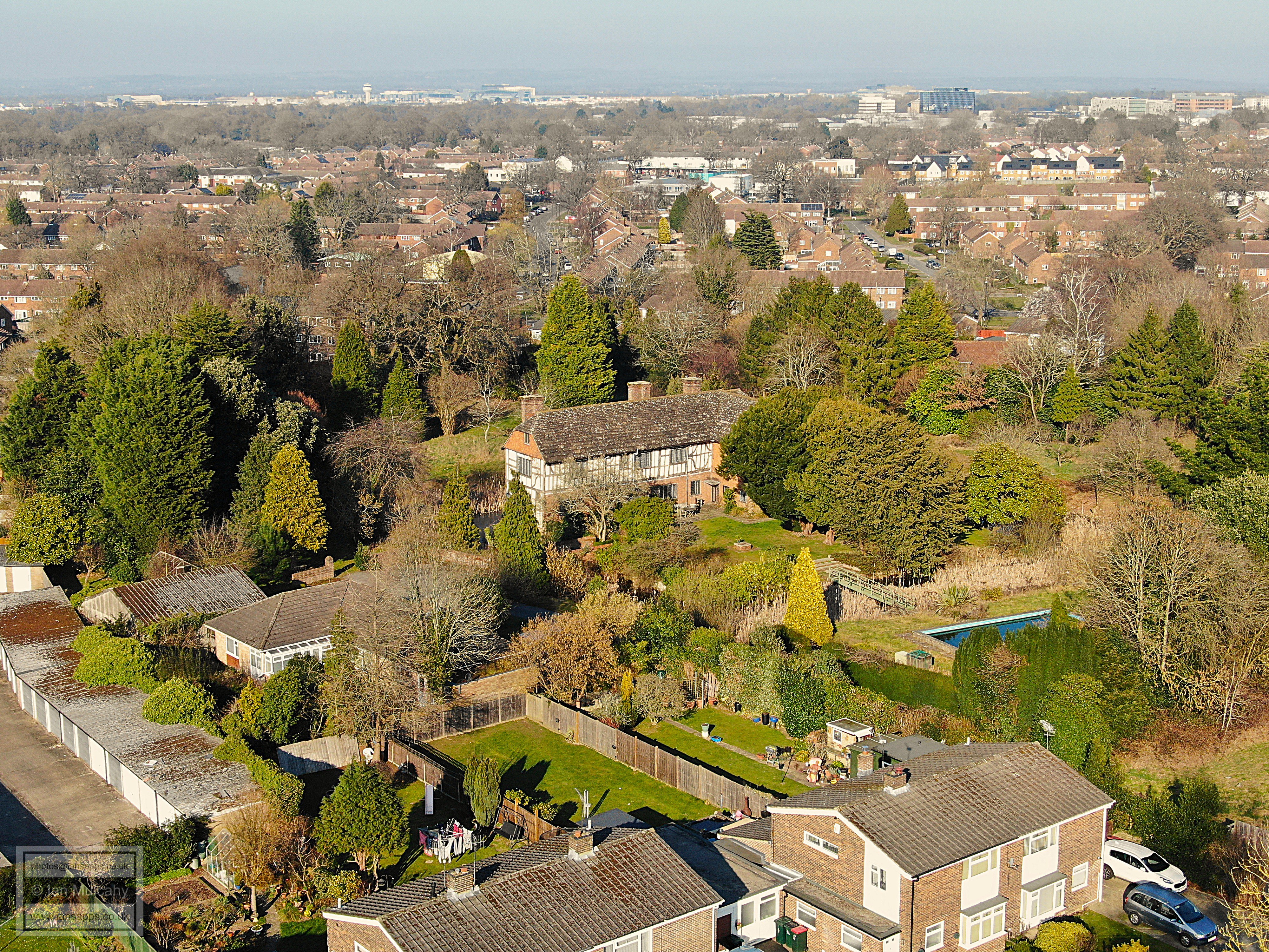
Two thirds of a mile east of St Margaret's Church is a medieval moated site; Ewhurst Place, just off of modern day Ifield Drive.
The name Ewhurst ("Yew Wood") is one of the area's oldest farm names, first documented in a taxation document of 1247 awarding the tithes of Ewerthe to Rusper Priory, and the site may have originally had a smaller outer ditch which could have pre-dated the main moat. Various members of the Ewhurst family (hereditary surnames didn't widely exist until the late 14th century and given names were embellished with reference to their farm or their trade; the original source of many surnames that we still see today) were recorded locally in the medieval period, including William, who was dealing with 1/2 yardland (a land tax unit) in Ifield in 1273, Thomas, who was taxed in Ifield in 1332 and another William who held a 'quarter fee' in Ifield in 1368, a fee (or 'fief', from where we derive fiefdom) being a unit of land deemed sufficient in size and productivity to support a knight! In 1447 a William Sidney was farming 800 acres at Ewhurst in Crawley and elsewhere. Whilst no physical evidence of a previous building on the site has ever been discovered (though the Victoria County History of Sussex suggests foundations from an earlier building exist in the northern section of the moat) it is clear from documentary evidence that Ewhurst has existed since at least the 13th century and, indeed, most moated sites date from between 1250 and 1350.
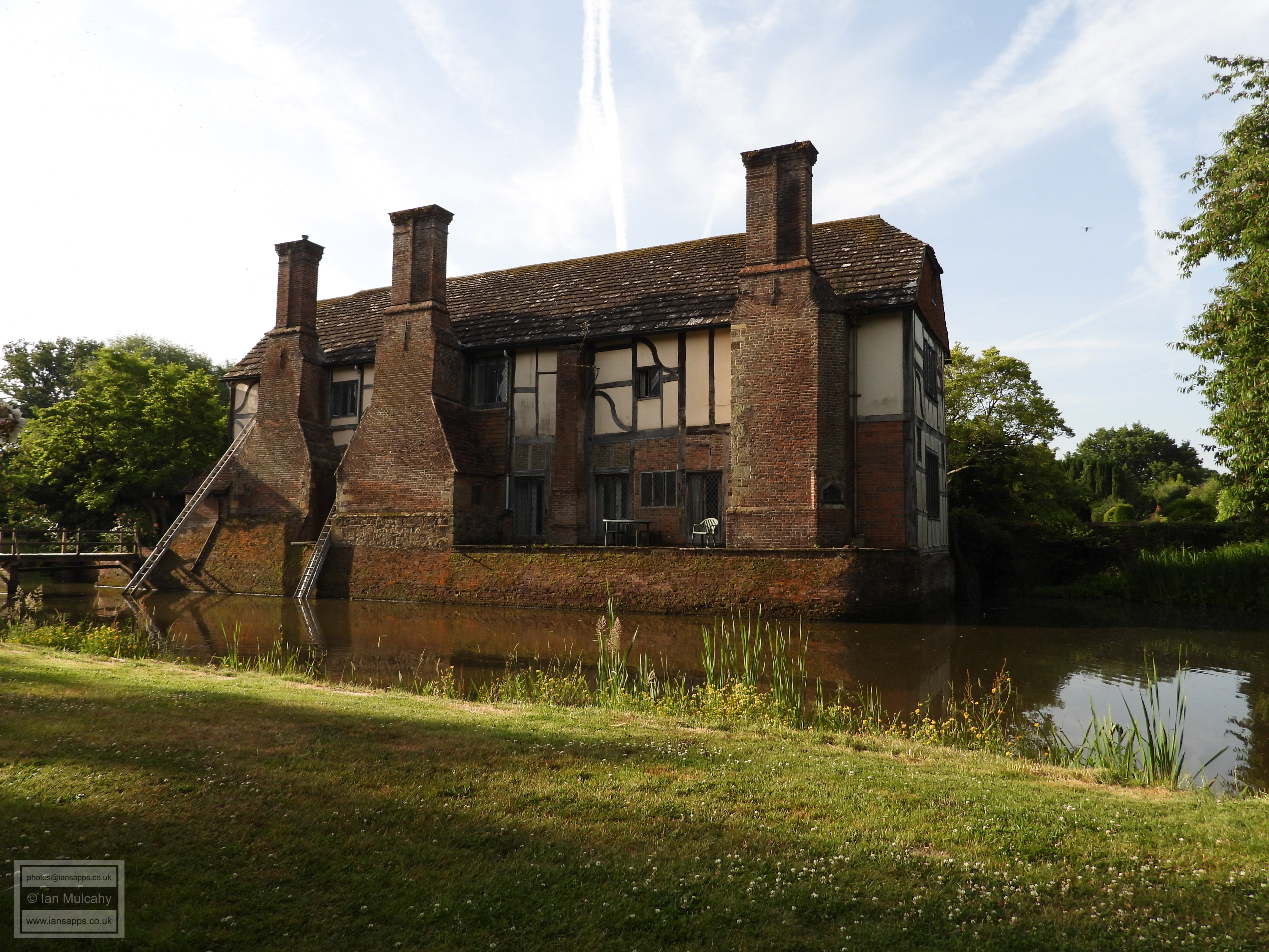
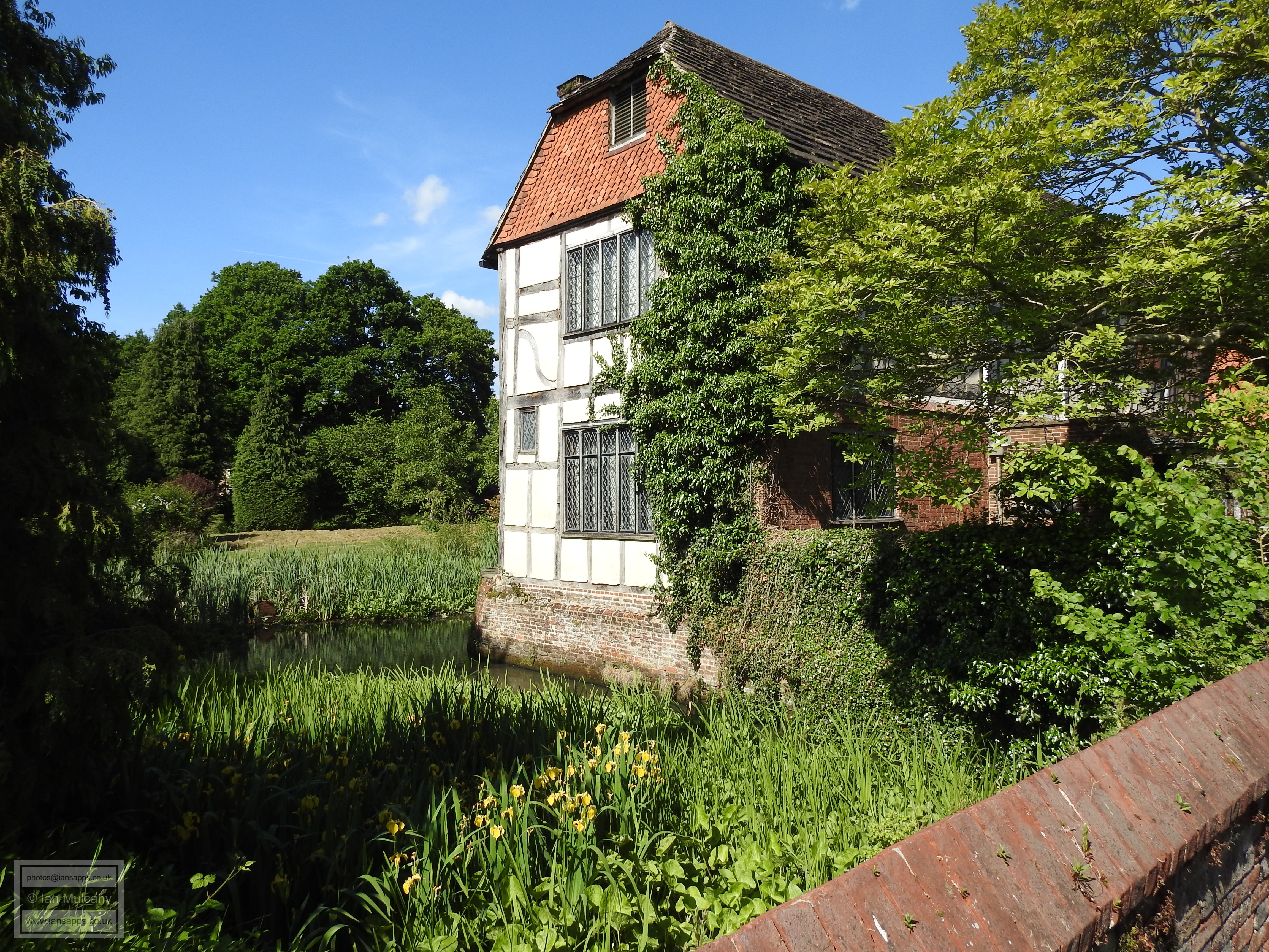
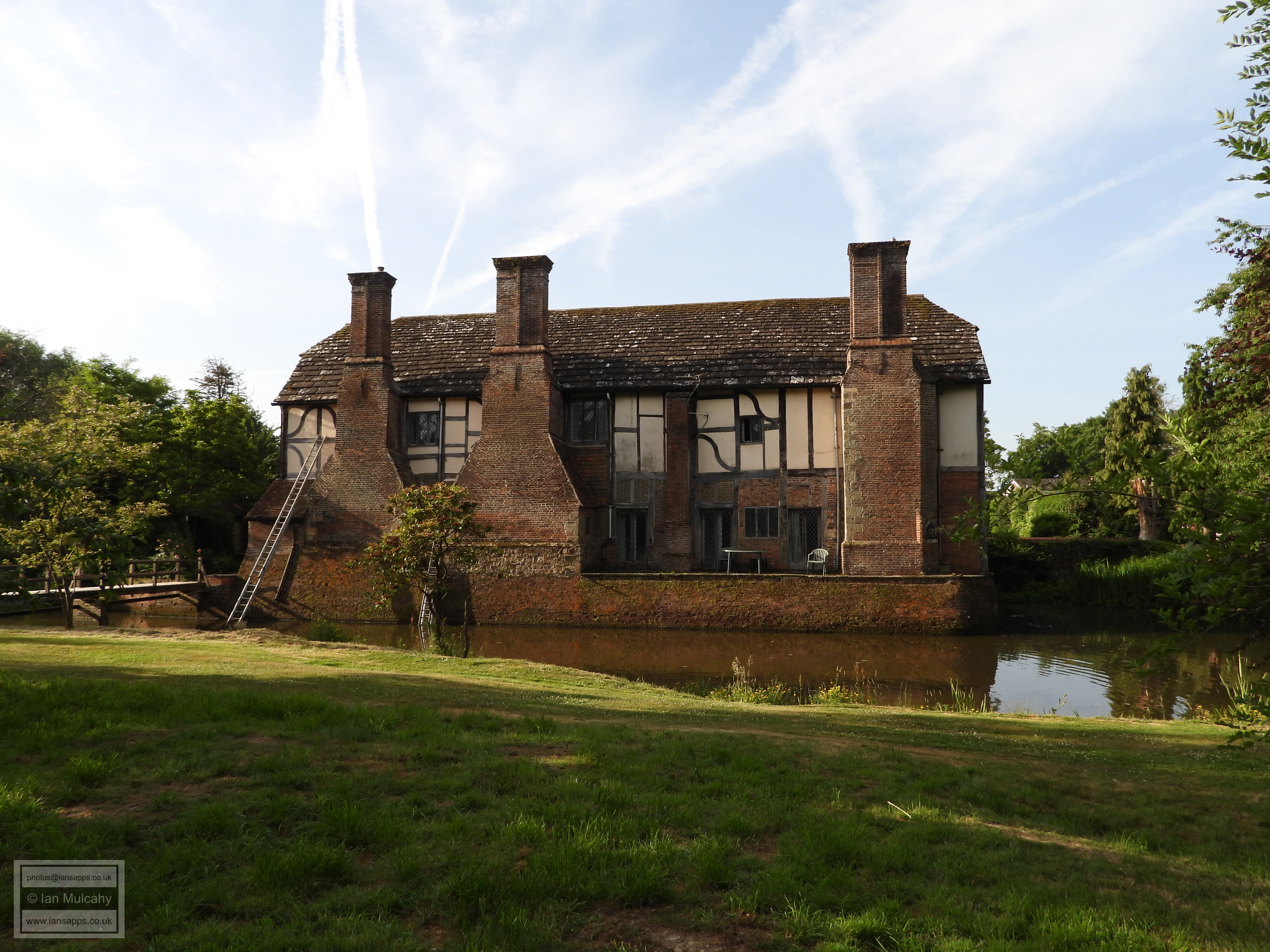
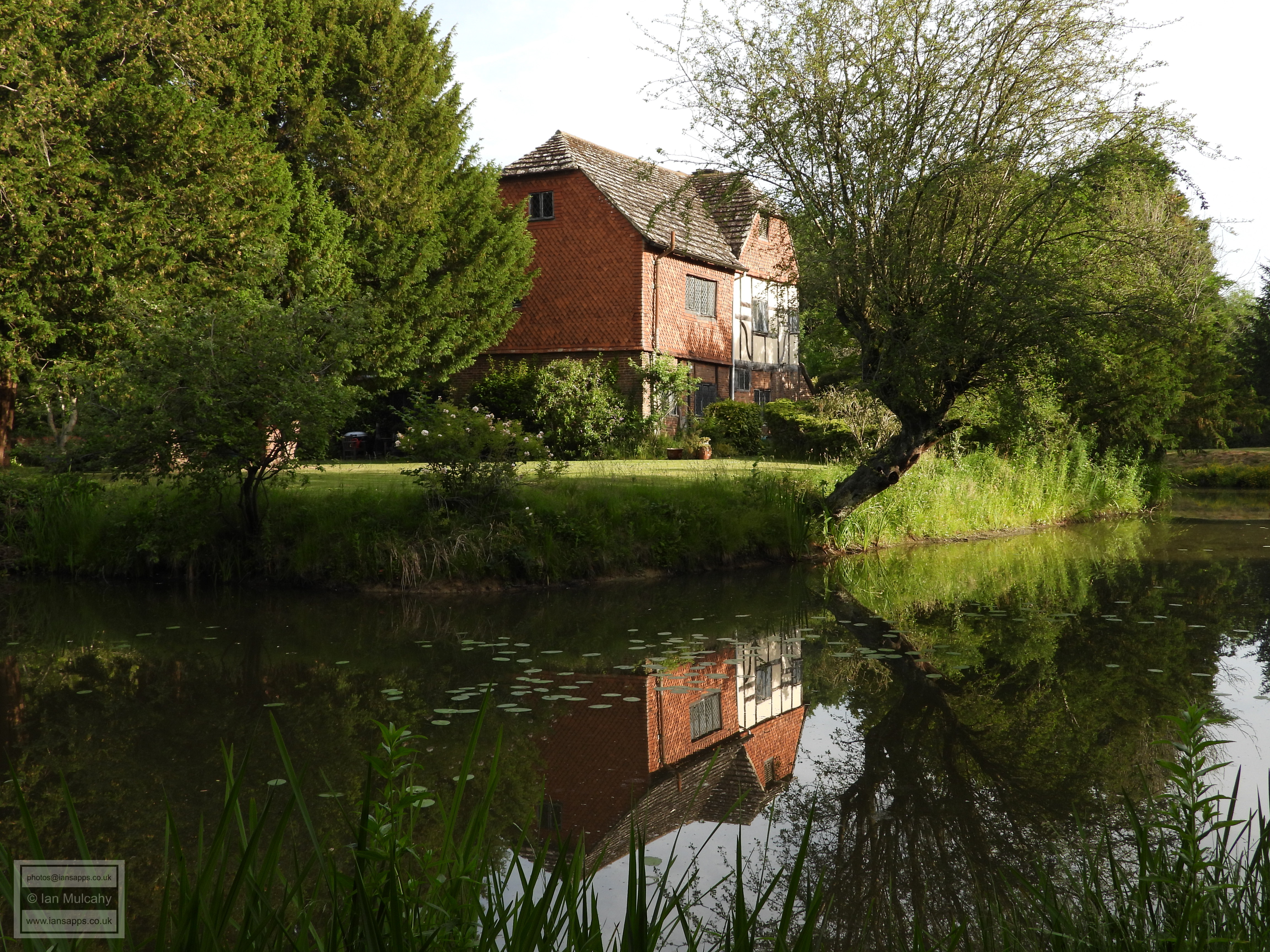
Ewhurst Place is the only complete survivor of the six known moated manors in the Crawley area, that is the complete moat and the house still exist. The current building is a grade 2* listed L-shaped timber-framed house of 2 storeys and attics occupying the north-west angle of the moated enclosure with the main range lying east to west which was probably built in the late 1500s and or very early 1600s. The south side, or the 'tail' of the L is faced with 18th century brick and it is believed that this marks a small extension of perhaps 3 metres at the point of the original entrance to the house. An external door frame can still be seen inside the building.
Pre New Town access was from Ifield Road via a driveway which is now the car park at Ewhurst Playing Fields, the first section of Findon Road and the entrance to Climping Road; see the final image on this page. The main current access to the island is via a (grade 2 listed) single arched brick bridge of the 18th century. On the island is a functioning well, partly fed by an original lead drainpipe descending from the roof, from which clean and unpolluted drinking water can still be drawn.


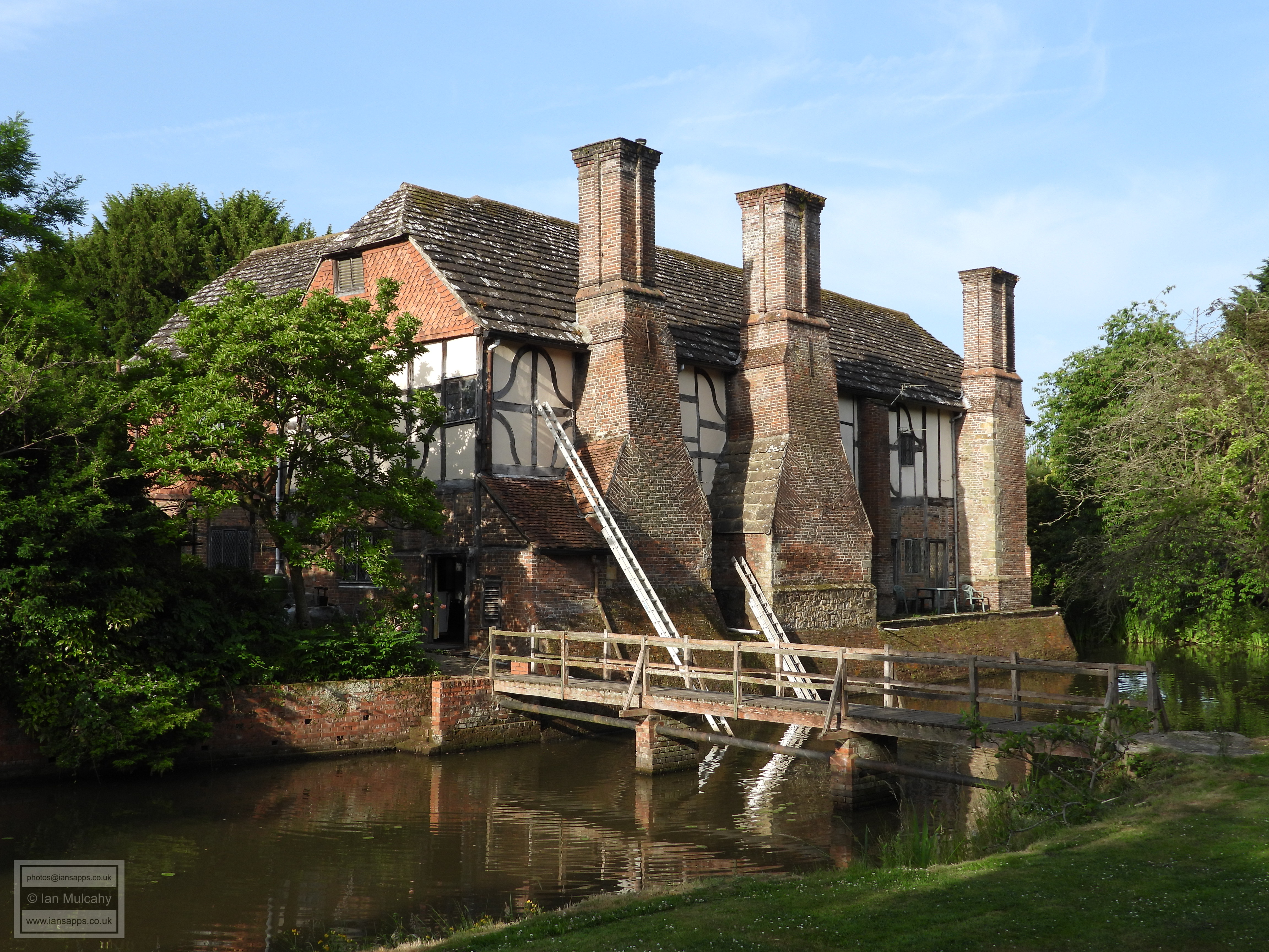


The Well, foreground, at Ewhurst Place


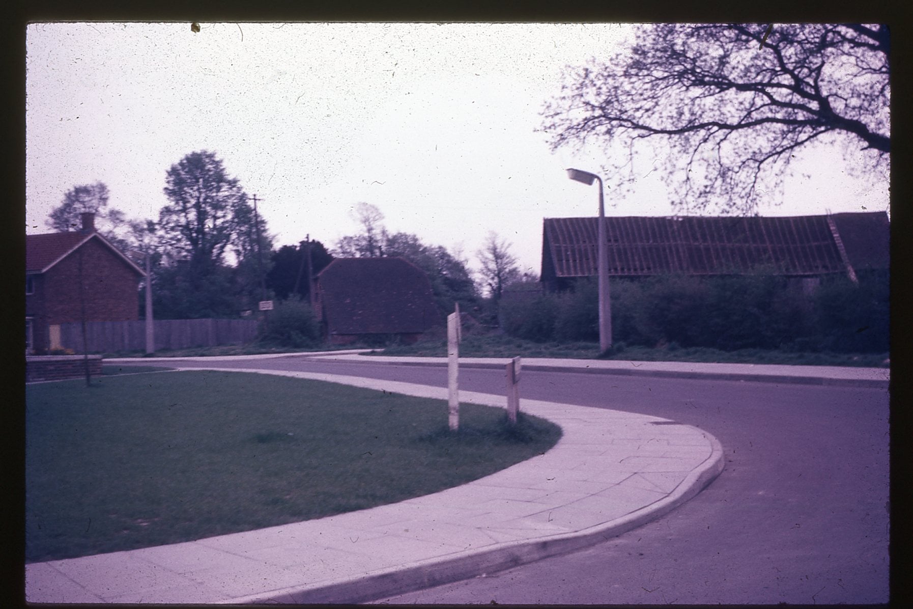
The original entrance to Ewhurst Place. What we see here is the entrance to Climping Road from Findon Road, which is in the foreground. Visible are the large barn (right) and granary (left) which were, in all likelihood, contemporary with the house, but were demolished by the Commission For The New Towns in order to build a garage block and numbers 34-42 Ifield Drive.
The photo was taken in the late 1950s and forms part of the Kevin Lee Collection.
An 'Ancient Ifield' Exhibition was held at Crawley Museum between 5 June and 5 July 2025. The posters that were on display at this exhibition can be downloaded from here. The video that was shown, including a version with an alternative soundtrack, along with the trailer used to promote it can be viewed here.
Text & photographs © Ian Mulcahy. Contact photos@iansapps.co.uk or visit my 'Use of my photographs' page for licensing queries.